Explore on two wheels: 14 of the best cycling routes in Sydney
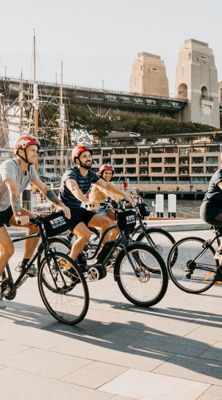
People enjoying Bonza Bike Tours, The Rocks

Destination NSW
Need to know:
One of the most popular harbourside shared paths in the Inner West, The Bay Run is a scenic 7km circuit never more than 20m away from the water. The flat pavement route attracts locals of all ages and abilities and can get busy with walkers, runners and rollerbladers, as well as cyclists, so keep an eye out as you ride. Don’t worry though, the gorgeous scenery around the Iron Cove foreshore is worth it. Be sure to stop off at Nield Park Pavilion for a coffee break and a muffin to reward your efforts.

Bay Run, Drummoyne - Credit: Ming Ye
Need to know:
Take your bike up to the Northern Beaches to cycle the Narrabeen Lagoon Trail, a stunning loop that hugs the enormous Narrabeen Lagoon. The route is flat and consists of sealed paths, smooth gravel and wooden boardwalks, and your journey takes you through all manner of ecosystems, revealing native wildlife and fascinating cultural heritage. As an added bonus, there are plenty of areas to stop for a picnic and public toilets are dotted around.
You can start the loop in a number of places but the main points are Middle Creek Reserve, Jamieson Park, Berry Reserve or Bilarong Reserve. Have your camera handy, because this bike trail is very easy on the eye.
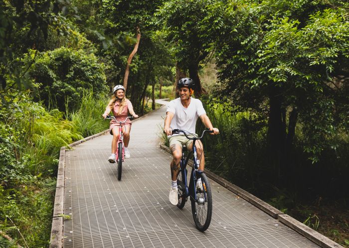
Narrabeen Lagoon Trail, Narrabeen
Need to know:
This sealed cycleway, separated from the main road, lets you explore Western Sydney in a safe way. The Prospect Loop follows a lot of Sydney’s historic water infrastructure, and has a range of terrain and scenery, making it ideal for both experienced and novice riders. The long loop connects Guildford and Canley Vale on the Parramatta-Liverpool train line and takes you as far as Abbotsbury (linger to visit Calmsley Hill City Farm).
If you’re getting to the loop via public transport, start from Guildford Station and look for Prospect Canal Cycleway running adjacent to Trenton Road. Bring your own food and break up the ride by stopping off for something to eat at Prospect Dam picnic ground. It’s the ultimate trail to get your legs moving, but be sure to pack plenty of food, water and sunscreen.
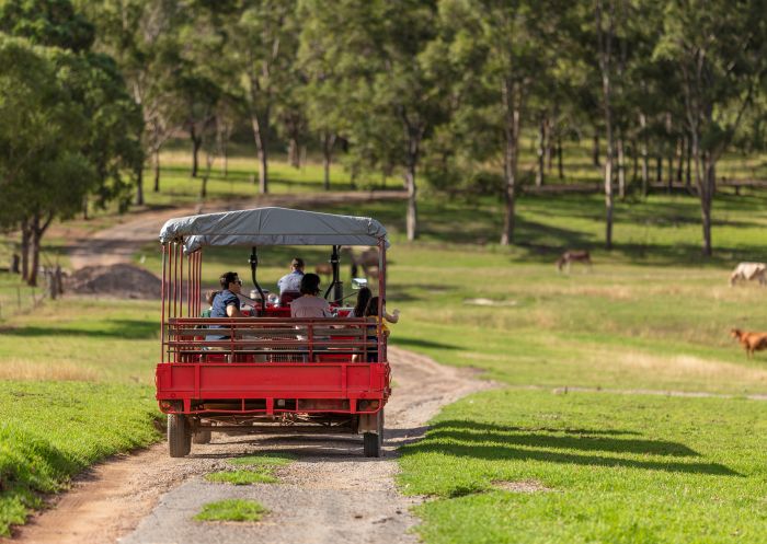
Calmsley Hill City Farm, Abbotsbury
Need to know:
Sprawling Centennial Parklands is one of the most bike-friendly public spaces in Sydney, with hundreds of thousands of cyclists riding in and through it annually. Located in the Eastern Suburbs, the vast space (which is actually three interconnecting parks) is webbed with trails that take you through shady groves, beside beautiful ponds and across open green spaces – nature rules here. It’s great to clock up some kilometres and keep fit, but equally fun for those looking for a leisurely ride.
The Grand Drive Cycle Lane is a 3.5km loop and is most popular for cyclists, but you can also create your own route to explore more of the park. For the less confident cyclists (children and beginners), there is a ‘Learners Cycleway’ that can be used to practice on. If you’re sticking to the main loop, remember to keep left and look out for the faster, more experienced cyclists overtaking. There are a few food and drinks outlets to stop at along the way to stay refreshed, and if you haven’t got your own bike, hire one at Centennial Park Cycles.
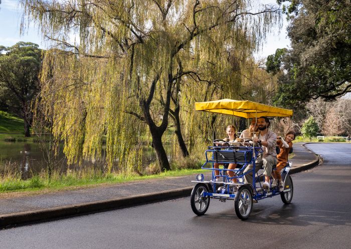
Centennial Park Cycles, Centennial Park
Need to know:
Find one of Sydney’s oldest and most popular rides on a 23km stretch between Ryde (in the north) and Botany Bay (in the south). The cycleway starts at Settlers Park and crosses the Parramatta River via the path on the eastern side of the Ryde Bridge, but you can access from numerous entry points, such as Bicentennial Park and Gough Whitlam Park.
Journey through parks and mangroves, pause at historical sites, cross scenic bridges and spot all manner of wildlife. This enjoyable ride is well signposted but there are many junctions so follow carefully. With plenty of places to stop and take a break, it’s perfect for a family day out.

Bicentennial Park, Sydney Olympic Park
Need to know:
One of the most dramatic coves in Sydney, Akuna Bay features waterfronts, bays, beaches and hills. This beautiful loop winds along the coast and into Ku-ring-gai Chase National Park in North Sydney, and has challenging technical climbs and descents that experienced cyclists will love. The all-road ride starts in Mosman and heads over the Spit Bridge towards the coast at Narrabeen. From there, it’s a relatively flat ride through Mona Vale and on to Church Point.
It’s a ride that will work up your appetite (and thirst) – we recommend pausing at The Waterfront Café & General Store to fuel up before the epic climbs ahead. The first is up McCarrs Creek Road and then onto West Head Road before you’re rewarded with a wonderful descent down to Akuna Bay. Another big climb out is followed by some fun roads through Terrey Hills and Frenchs Forest, until you start retracing your steps back toward the Spit for the end of the ride. Bring your stamina!
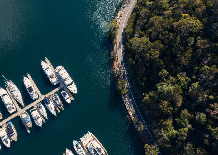
Akuna Bay, Ku-ring-gai Chase
Need to know:
Detour from the busy Sydney CBD roads and cruise along dedicated bike paths, quiet streets and the river foreshore between Parramatta Park and Sydney Olympic Park. The Parramatta Valley Cycleway meanders along the Parramatta River and is perfect for all ages and riding abilities.
The route can be as long or as short as you want it to be. Add on a few loops of Parramatta Park, ride all the way to Morrison Bay Park, choose to take either the Silverwater Bridge or John Whitton Bridge, or you can even add on a few kilometres in Sydney Olympic Park. Be sure to explore the latter as there are plenty of things to see and places to eat.

Parramatta Park, Parramatta
Need to know:
With more than 35km of cycle paths for safe bike riding, Sydney Olympic Park is ideal for cyclists of all skill levels. Why not check out the popular 7.5km Olympic Circuit and relive memories of the 2000 Sydney Olympic Games? Start within the Town Centre and take a journey past iconic Olympic venues like the ANZ Stadium, the Olympic Cauldron, Cathy Freeman Park and the Games Memories poles installation, a permanent tribute to the volunteers who made the Sydney 2000 Olympic and Paralympic Games such a magnificent occasion. Cycle hire is available within Olympic Park so don’t worry if you haven’t got a bike.
With lots to see and many places to eat and drink, you’ll be able to keep the whole family entertained. Also check out the River Heritage Circuit (running along the Parramatta River) and The Parklands Circuit (starting in Bicentennial Park and finishing in Waterbird Refuge via Lake Belvedere).
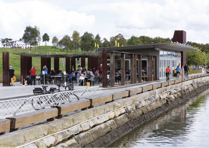
Newington Armory, Sydney Olympic Park
Need to know:
If you’re looking for a long bike ride to get your blood pumping, free from cars and traffic lights, then check out the dedicated cycleway that runs next to the M7. This $60m project joins Prestons and Glenwood in Western Sydney on a 40km uninterrupted stretch with more than 60 entry and exit points.
Attracting thousands of riders at the weekend, this is a popular route and takes you to popular attractions like the Western Sydney Parklands. If you decide to tackle this one, make sure to take enough water as there is only one place to fill up at about the halfway point.
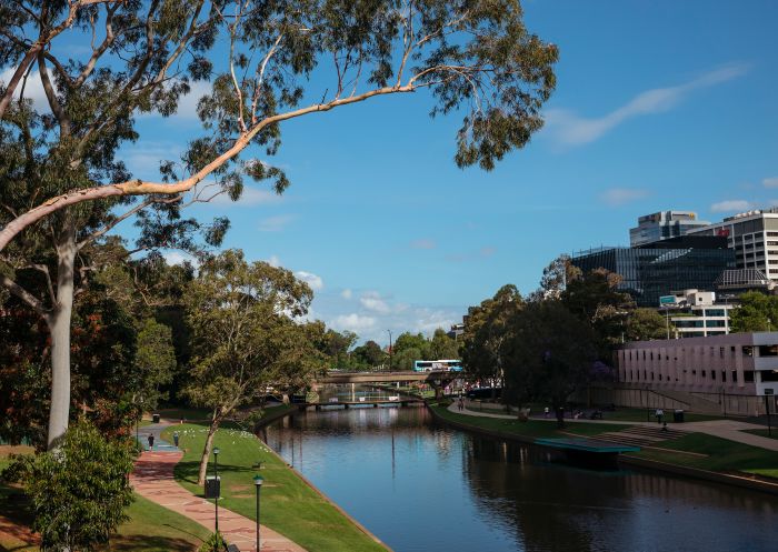
Parramatta River, Parramatta
Need to know:
Meandering through Dharawal National Park near Stanwell Tops south of Sydney, the 10B Cycling Trail is an ideal route for avid cyclists looking for a long bike ride with a picturesque picnic spot along the way. The 15km trail starts near the Appin Road entrance of Dharawal National Park and takes you on an unsealed road through woodlands and open forest. The relatively easy ride becomes more challenging in the last 3km, when you descend into Stokes Creek Gorge and have to climb back up to the park’s northern entrance at Wedderburn.
Highlights of this fun ride includes the creek crossing which has a broad rock platform perfect for a quick break. Also, look out for yellow-tailed black cockatoos, with their distinctive ‘kee-ow’ contact call.
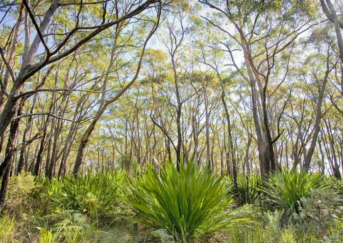
10B Cycling Trail - Credit: Nick Cubbin
Need to know:
One of the most postcard-perfect cycling trails in the Royal National Park, just south of Sydney, the Loftus Loop Trail is a fun 10km ride consisting of 8km of fire trail and 2km of designated bike track. It’s accessible from a number of locations, although most people begin and end at the NPWS office.
The trail is diverse and features varied terrain – from flat, wide-open tracks to steep, rocky fire trails that can test your mettle. Inexperienced riders should take care along the latter. While you’re there, why not take a picnic and stop for lunch at Ironbark Flat picnic area, or go to the Audley Dance Hall Café for coffee and cake?
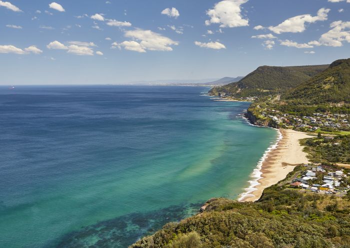
Stanwell Tops Lookout, Royal National Park
Need to know:
Want to enjoy coastal views with plenty of places to stop off? Start at Tempe Recreation Reserve in the south, near the airport, and make your way over the Cooks River on the shared pathway, down toward Brighton-Le-Sands and Sans Souci where you’ll hug the coast of Botany Bay. There are plenty of places to grab food along this stretch before you venture over Captain Cook Bridge. Once over, keep left and continue on the cycle path until you eventually reach Captain Cook Drive, where you’ll stay on this all the way to Kurnell.
While you’re in the area, explore a little further into Kamay Botany Bay National Park to Cape Solander Lookout, where you might even spot whales during migration (May to November). From here you could retrace your steps and head down to the beautiful beach at Cronulla and treat yourself with a well-earned beer and pub lunch. If you can’t face the journey back, you can always catch the train back to the CBD.
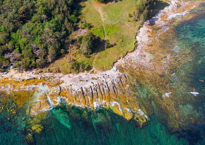
Kamay Botany Bay National Park, Kurnell
Need to know:
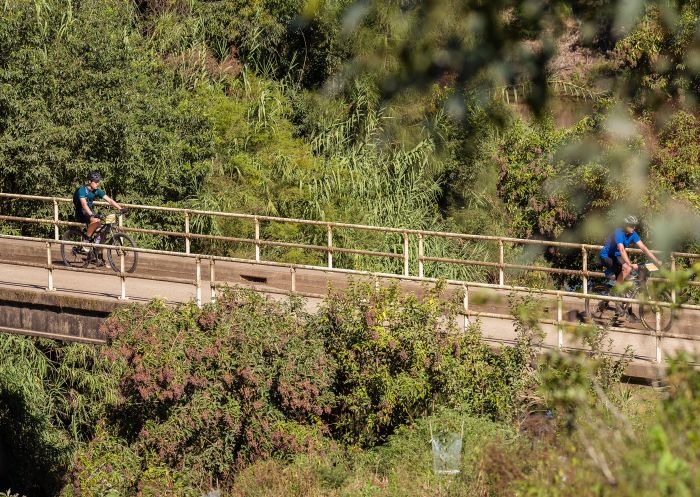
A classic ride among Sydney’s avid cyclists escaping city life, the Three Gorges will definitely test your fitness. This is a strenuous but rewarding 60km trek in Northern Sydney, where you’ll experience some serious climbs, intense switchbacks and great downhill stretches – all the while enjoying awesome views of the Hawkesbury River and Ku-ring-gai’s scenery.
As the name suggests, there are three gorges to tackle: Galston Gorge, Berowra Waters and Bobbin Head. Starting from Hornsby train station going clockwise, you’ll encounter the first climb just after Galston. When you arrive at Berowra Waters, you’ll have to get a ferry across. It’s a good time to refuel and prepare yourself for the gruelling second climb, which is soon to come. As this is all on-road cycle, ensure you’re experienced and comfortable with potentially busy car traffic.
Convict 100, St Albans
Need to know:
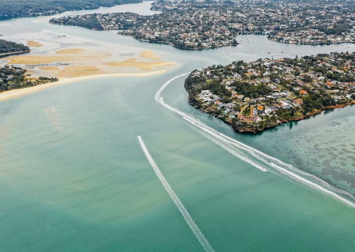
If you’re looking for an easy, off-road bike trail for all the family, this is the one for you. It follows the Hacking River in Sydney’s southern Royal National Park. And boy, is it pretty – you’ll meander through forests of blue gums, turpentines and patches of rainforest, while heading over a number of creeks. You might encounter a lyrebird, echidna and lace monitor along the way.
This one-way trail can be done in either direction. To start at the northern end, head to Fig Tree Flat car park. Alternatively, go to Forest Path car park, just off Sir Bertram Stevens Drive near the Waterfall train station exit for Princes Highway. Remember to watch out for walkers on this shared track and check the weather before going, because Lady Carrington Drive can become boggy when it rains.
Maianbar, Sydney
Stay connected to Sydney for all the latest news, stories, upcoming events and travel inspiration.
All the insider news, tips and inspiration you need to plan your next trip, delivered straight to your inbox.
Sign UpSydney.com is the official tourism site for Destination NSW.
© Copyright 2026 Destination NSW. All rights reserved